
This website uses its own or third-party cookies. By continuing to browse, you consent to our use of these cookies.. If you wish, you can modify your preferences in your browser.
The Data and Life of Great Future Cities
London 2026: Recipes for Building a Food Capital
Idencity: Six Designs from the LSA to Challenge the Identity of London
- 15Sep
- 26Jan
 15/09/18 to 26/01/19
 Roca London Gallery (How to reach us)
Can data collection actually be good for us? Roca London Gallery’s autumn 2018 exhibition The Data and Life of Great Future Cities proposed that, used responsibly, personal data could be the key to better urban design.
The exhibition title was inspired by the now iconic 1961 book The Death and Life of Great American Cities, by pioneering urbanist, activist and writer Jane Jacobs. In it, controversially without extensive evidence gathering, Jacobs managed to identify the four conditions required for successful city planning, or the “four generators of diversity”. Her theories have now been proved uncannily accurate by a team of researchers at The University of Trento, led by Marco De Nadai, whose work was part of the Roca London Gallery show. De Nadai’s development of a much cheaper and quicker alternative to the lengthy and costly collection of survey data, or studies of pedestrian activity, used a new generation of city databases – such as OpenStreetMap and Foursquare – combined with mobile-phone records, showing the number and frequency of calls in an area, to identify a city’s most vibrant areas. This methodology is groundbreaking for city planning as it offers an evidence-based, objective toolkit for assessing aspects such as the quality, vitality and diversity of city life. Rather than relying on a satellite-style view, we’re now able to understand how a city works from street level up, providing an empirical way into what Jacobs called “the adventure of probing the real world”.
De Nadai’s work is just one of the exhibition’s examples of how data mining can support human-centered urban design, as exhibition curator Eva Woode commented: “By studying these projects, in which data mining essentially becomes a new tool to learn about how people use and perceive cities, we’ve found that researchers such as the MIT Senseable City Lab are progressing the tradition of urban observation pioneered by Jane Jacobs, albeit with modern technology and on a massive scale. Through this exhibition, we’ve highlighted these new tools, and also tried to put contemporary approaches to studying a city at street level into historical context.”
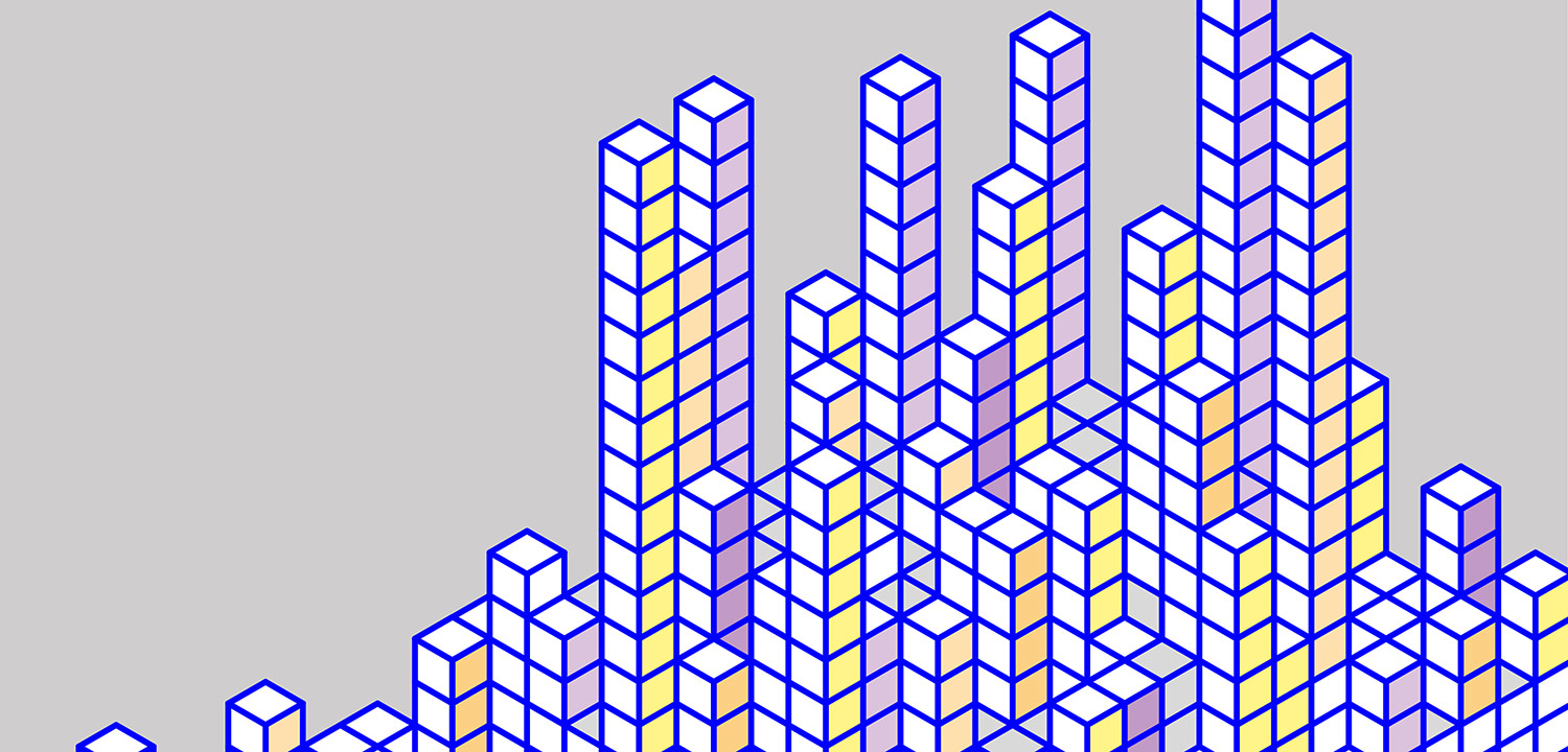
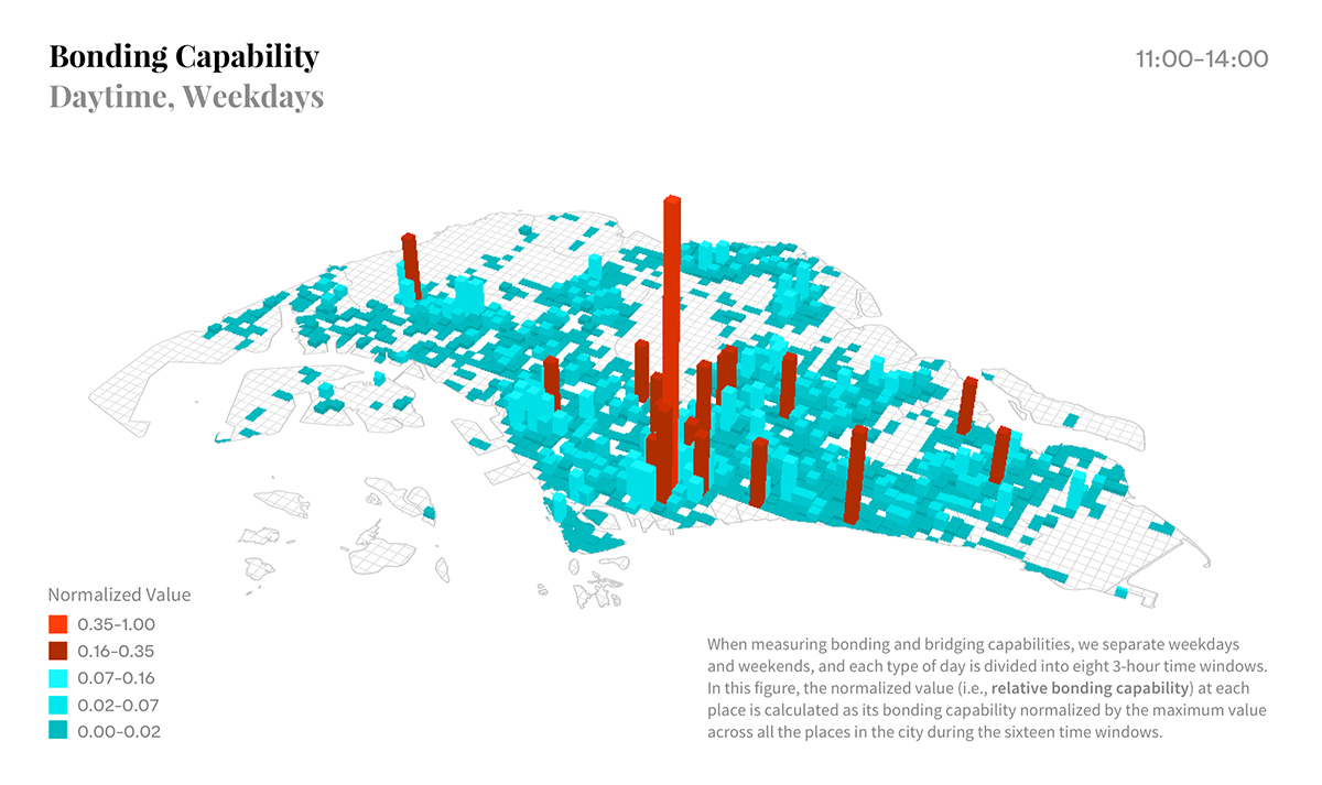
The show’s opening section reviewed historical approaches to urban design, dating back to ancient times when city planning could as easily be victim to the whim of a dictator as configured to honour a spiritual figure. Tools for studying cities now and how we might adapt them for the future were illustrated through a number of projects, including two examples from MIT’s Senseable City Lab, led by Carlo Ratti: Friendly Cities and Treepedia. The former is based on a Singapore-based study, where personal data is less tightly policed than in the UK. By extracting information from mobile phone data, MIT Lab can demonstrate how, as people move about the city, they either ‘bond’ through deliberate connectivity with friends or ‘bridge’ via chance encounters with strangers. This has enabled them to map places in the city that bring people together.
Using Google Street View data, Treepedia allows the comparison of tree canopies in cities around the world. A city’s tree canopy affects urban temperatures and mitigates air pollution, while the trees’ absorptive root systems help to avoid floods during severe rains and storm surges. Importantly, there are also proven health benefits to living within view and shelter of greenery.
Fábio Duarte, Research Scientist, MIT Senseable City Lab, commented: “Our research shows that using aggregated, anonymised data – which is already being generated and collected, for example, whenever we use our smart phones – opens up new possibilities of designing cities that are better adapted to human needs. For instance, all smartphones have an embedded accelerometer that can measure effects such as bridge vibrations. Given that, in the United States alone, thousands of bridges have infrastructural problems, ‘opportunistic’ data gathering from smartphone-carrying drivers provides an invaluable real-time bridge monitoring system. This is where big data starts to solve big problems!”
-
15/09/18 to 26/01/19
- Roca London Gallery (How to reach us)
-
Other exhibitions
-
- 09Feb
- 19May
Timber Rising: Vertical Visions for the Cities of Tomorrow- From 09 Feb 2018 to 19 May 2018
The last exhibitions
-
- 19Apr
- 30Sep
Bio-Spaces: Regenerative, Resilient Futures
- From 19 Apr 2024 to 30 Sep 2024
© Mamou Mani Architects
Exhibition